-
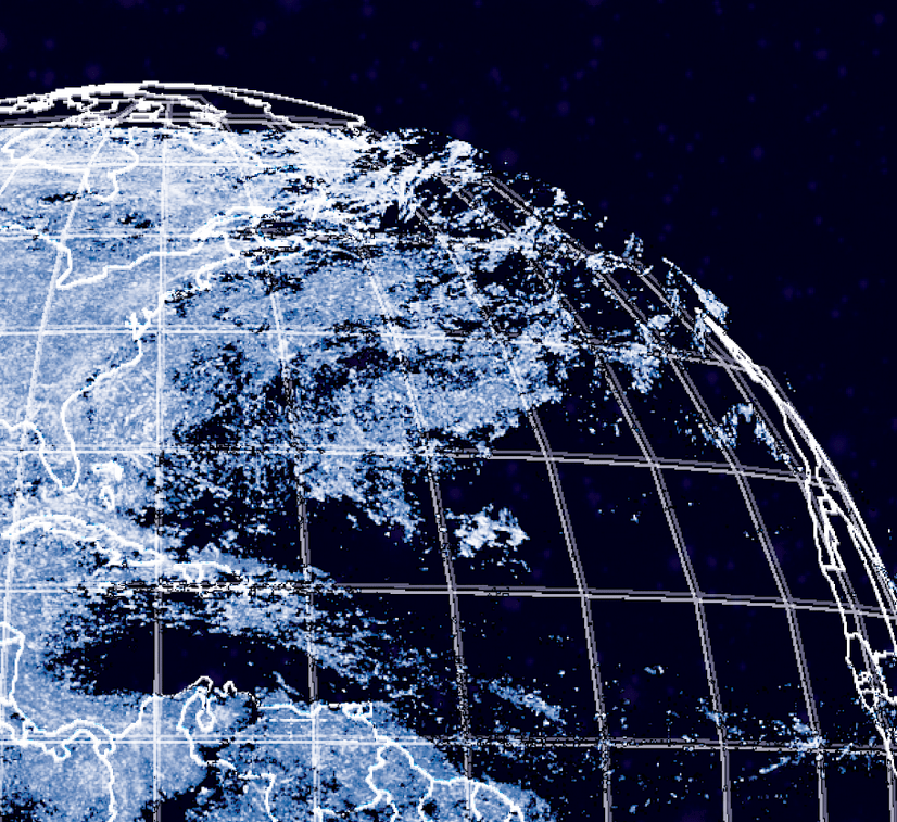
What GOES Around
This map is a science project, looking at data captured by the Geostationary Operational Environmental Satellite (GOES) network and involving a heck of a lot of Python programming. More info on the GOES network…
-
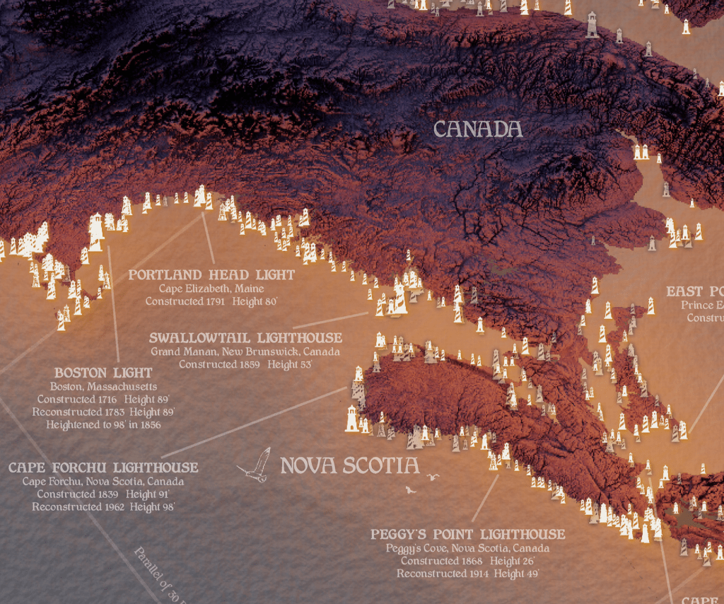
Lights on the Atlantic
Lights on the Atlantic is a labor of love. This map is a result of 60+ hours of data collection, 20+ hours learning some basic 3D rendering techniques in Blender, and 20+ hours of…
-
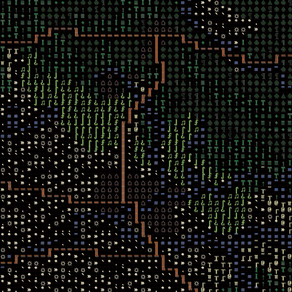
>TYPE arizona.txt
>TYPE arizona.txt is a map I put together for the Arizona Geographic Information Council (AGIC) annual meeting in 2025. It’s entire purpose is to distill a few datasets (roads, rivers, land cover categorized as…
-
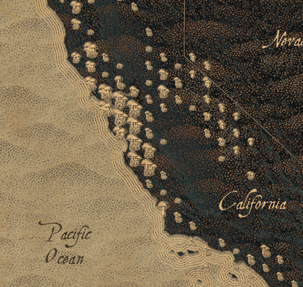
Mycologia Pacifica
Mushrooms of the North American Pacific Mycologia Pacifica is an attempt at a k-means cluster analysis of a few prominent types of mushrooms along the Pacific coast of the United States and southwestern Canada.…
-
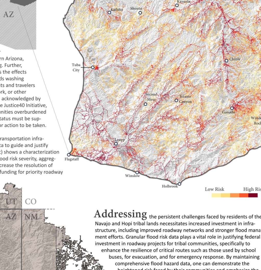
Detour Ahead
Visualizing Flood-Related Impacts of Under-investment in Tribal Roadway Networks in Northeastern Arizona Detour Ahead is an infographic illustration of roadway flood risks across the Navajo Nation and Hopi in northeastern Arizona, highlighting the impacts…
